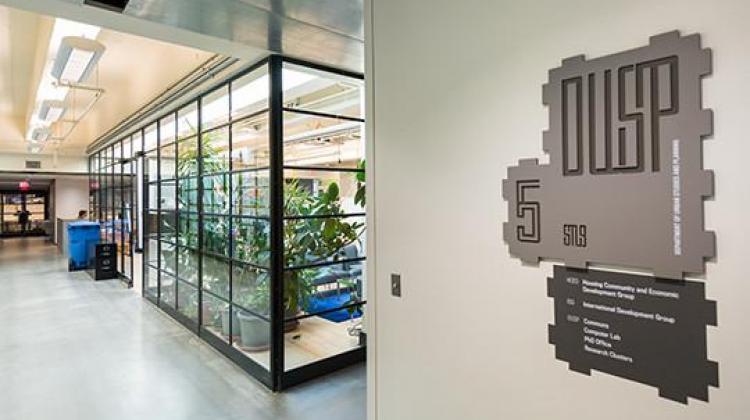
About

  • Image

    Justin Knight

    Building 9, MIT

Since its founding nearly 90 years ago, the Department of Urban Studies and Planning at MIT has consistently been rated the premier planning school in the world. We are home to the largest urban planning faculty in the United States and enjoy the advantage of operating within the context of MIT’s culture of innovation and interdisciplinary knowledge creation. We provide our students with an education that combines rigorous academic study and the excitement of discovery with active engagement in the practice of place-making to understand and solve pressing urban and environmental problems.

Key Facts

  • The Department of Urban Studies & Planning (DUSP) is a department within the School of Architecture + Planning at MIT
  • Year founded: 1933 
  • Degrees Offered: Bachelor of Science in Planning (SB);  Bachelor of Science in Urban Science and Planning with Computer Science (SB); Master in City Planning (MCP); Master of Science in Urban Studies and Planning (SM); Master of Science in Transportation (MST); Doctor of Philosophy (PhD) 
  • Number of graduate students (2021-2022): 110 (71 Master, 39 PhD) 
  • Number of faculty: 32 
  • The Planetizen Guide to Graduate Urban Planning Programs once again ranked DUSP #2 in the U.S. and Canada

Mission + Guiding Principles

Mission

We prepare leaders to plan, design, and create communities and places that are racially, economically, and environmentally just.

We pursue this mission through four evolving strategic priorities: achieving racial justice, enhancing mutli-racial democratic governance, tackling the climate crisis, and closing the wealth gap.

We aim to fulfill our mission through all aspects of our teaching, research, department culture, and external collaborations.


Approaches to Action

Leadership: Providing creative learning environments to develop, support, and nurture leaders whose practice and scholarship aim at improving quality of life through the planning and design of human settlements.

Knowledge: Fostering multiple ways of knowing, innovating within and between methods and approaches, and co-creating place-based practices for positive impacts at a global scale.

Integration: Bridging teaching, research and external relationships with a supportive and inclusive internal culture that enables risk-taking and experimentation. 

Values

We aim to embody the MIT Values of Excellence and Curiosity, Openness and Respect, Belonging and Community. 

Read the full Values Statement.  

Anti-Racism

The reality of the world today urgently calls us to reimagine what is required to build inclusive, thriving, and sustainable communities. We cannot ignore the complicity of planning in structural global human rights abuses such as Anti-Black racism and White supremacy and more broadly the legacies of colonialism and exclusions based on race, class, religion, and/or gender. Building communities based on equity and inclusion is planning’s duty. Only by dismantling systemic racism can we confront the overlapping social, environmental, health, and economic crises facing cities globally. DUSP is committed to an ongoing anti-racist transformation of our departmental culture as well as our approach to teaching, research, practice, and career development.

Land Acknowledgement Statement

We acknowledge Indigenous Peoples as the traditional stewards of the land, and the enduring relationship that exists between them and their traditional territories. The lands which MIT occupies are the traditional unceded territories of the Wampanoag Nation, and the Massachusett Peoples. We acknowledge the painful history of genocide and forced occupation of these territories, as well as the ongoing processes of colonialism and dispossession in which we and our institution are implicated. Beyond the stolen territory which we physically occupy, MIT has long profited from the sale of federal lands granted by the Morrill Act, territories stolen from 82 Tribes including the Greater and Little Osage, Chippewa, and Omaha Peoples.

As we honor and respect the many diverse Indigenous people connected to this land from time immemorial, we commit our work to restoration, offer Space, and seek to leave Indigenous peoples in more empowered positions.

Governance

A number of committees are involved in the day-to-day operation of the department. Some of these committees offer students the opportunity to play a direct role in departmental governance. The DUSP Student Council (DSC) holds elections to name students to DUSP committees, typically at the start of the fall semester. Click on any of the committees below to learn more about their members and their responsibilities.

Department Headquarters (DUSP HQ)

Responsible for departmental administration as well as the financial, research, and educational leadership in the department.

Program Group Heads

Responsible for administration and direction of the curriculum program groups in the department.

Doctoral (PhD) Committee

Administers the rules and regulations of the program, makes decisions regarding the academic status of students, sponsors changes in the rules and policies, makes financial aid allocations, and administers the admissions processes for the doctoral degree program.

Master in City Planning (MCP) Committee

Administers the rules and regulations of the program, makes decisions regarding the academic status of students, sponsors changes in the rules and policies, makes financial aid allocations, and administers the admissions processes for the master of city planning degree program.

Undergraduate Committee

Administers the rules and regulations of the program, makes decisions regarding the academic status of students, and sponsors changes in the rules and policies.

Steering Committee

The DUSP Steering Committee (StCom) is a consultative committee, comprised of Faculty and Senior Staff, that aims to represent a range of intellectual (e.g., Program Groups) and mission-focused (e.g., Degree Programs) areas of the Department. At the broadest level, the StCom helps set the strategic direction of the department and ensure that direction and related decisions have broad input from DUSP’s “constituencies.” The StCom’s activities include:

  • Advising leadership (e.g., DH, Degree Programs) on key decisions.
  • Serving as an intermediary body with the rest of the community to vet proposed initiatives
  • Sharing information, between departmental leadership and the broader community, and vice versa.
  • Priority setting, helping to chart the Dept’s strategic direction.
  • Coordinating, to ensure coherence across, for example, degree program committee initiatives, needs and resources.
  • Managing crises, to help identify and solve problems in a peer-to-peer based working environment.

Rarely is the StCom a decision-making entity; it aims to help DUSP strike a balance between a centralized and decentralized structure. Most decision making occurs in, e.g., the Degree Programs, among the full faculty, or in HQ.

Membership:

  • Department Head (convenes)
  • Associate Department Head(s)
  • Administrative Officer
  • Special Advisor to the Department Head
  • MIT/CRE Faculty Director
  • Degree Program Chairs/co-Chairs
  • Program Group Heads

Program Groups, Initiatives, and Labs

DUSP’s Program Groups (City Design and Development; Housing, Community, and Economic Development; International Development; Environmental Policy and Planning) have long provided the pillars upon which DUSP’s intellectual life is structured. That said, DUSP draws together people with a range of disciplines and interests – from urban design to anthropology, engineering to economics, law to epidemiology, computer science to among others.
 
DUSP’s work, and intellectual life, requires that we cross boundaries rather than be bound by them. As such, Program Groups serve as a gateway to the department and its rich ecosystem of research and action labs and initiatives. Among those are the Mobility Initiative and Urban Science. A hallmark of nearly all the work we do is direct engagement with stakeholders – including with: community members/residents; government agencies and operators; private companies; and quite often in collaboration across these and other stakeholders.

For a more complete picture of our research and action labs and groups, please visit our lab page.

Additional Context

Brief History

City Planning, was first offered at MIT in September 1933 and led to the degree of bachelor in architecture (Course IV-B). The object of the new course was to “encourage in the architectural student a breadth of outlook which will enable him to see city planning problems in a broad perspective,” and to equip him so that he is “qualified to cooperate intelligently with engineers, landscape architects, lawyers, economists, and sociologists in the planning or replanning of urban areas.”

The five-year course was taught from the architect’s perspective and required the student to complete the first three years of the architectural curriculum or an acceptable equivalent.

In 1935 the Executive Committee of the Institute’s Corporation approved a master’s program called the Master in City Planning (MCP) and courses in city planning, design and research and administration were approved by the faculty. Harvard University closed its School of City Planning the following year, and MIT became the only institution offering a master’s degree in city planning in the United States at that time.

In 1942 Course IV-B was renamed City and Regional Planning and reduced to a four-year program with a new curriculum that was no longer parallel to the program in architecture but included planning courses in the first year and an office practice course in the summer of the third year. The following year the School of Architecture became the School of Architecture and Planning to reflect the growing importance of the subject to the profession of architecture.

In February of 1947 Course IV-B became the Department of City and Regional Planning (DCRP) in the School of Architecture, and Adams became the first department head. Enrollment in the program more than doubled the prewar figures; graduate students outnumbered undergraduates and the demand for planners exceeded the number of students graduating. Because the field was a relatively new one, the members of the new department struggled to obtain enough adequately trained personnel to meet the demand and to maintain high standards of instruction. The department continued to accept as its primary responsibility the training of technically qualified practitioners in the field of city and regional planning and housing rehabilitation.

In 1954 the DCRP undergraduate program was eliminated and the department became a graduate school, offering only the two-year M.C.P. degree. Planning courses at the undergraduate level were offered as electives. The M.C.P. program focused on the study of the large-scale physical environment and its interaction with society.

By 1955 many of the planning positions obtained by the graduates of the program required policy decisions of both an economic and an administrative nature. Students looking for relevant training sought interdepartmental degrees at the doctoral level. This growing phenomenon, coupled with an interest on the parts of educational and operating institutions in planners with more advanced training, led the DCRP to consider offering a doctoral program within the department.

In 1958 the M.C.P. program changed its core curriculum to stress the planning and design aspects of the city as a whole and to decrease emphasis on the design of small elements such as subdivisions. Also in 1958 the department first offered a Ph.D. program in city and regional planning and the Center for Urban and Regional Studies was established under the directorship of Lloyd Rodwin. A parallel center was established at Harvard and the two were intended to be integrated and interdisciplinary in their research approaches. The focus of the center’s research was the physical environment of cities and regions, the forces that shape them, and the interrelations between urbanization and society. The key areas of interest included the form and the structure of the city, transportation, technology, controls, the planning process, the urban landscape, and the physical planning problems of developing countries. The center greatly enhanced the research potential for students and faculty of the DCRP.

In 1961 a new research methods course provided training in the application of modern electronic computing to planning problems. New M.C.P. and Ph.D. curricula offered during the same period focused on the visual design of cities, regions, or large city areas, with a view towards the objectives of redevelopment projects, and larger issues involved in urban renewal. Also in 1961 the high demand for planning education by foreign students from developing countries caused the department to examine the very different training such planners would require. In 1966 Course IV-B became Course XI. By 1967 the heightened interest in urban problems and urban studies throughout MIT increased both the research and teaching capacity of this multidisciplinary field. Within the department, work developed primarily in four directions: city design; planning for developing areas; urban planning and social policy; and quantitative methods.

Also in 1967 the department initiated the Special Program in Urban and Regional Studies (SPURS), funded by the Ford Foundation. The program offered a fellowship for one year of intensive study to international students, with preference given to persons from developing countries. The fellowship was aimed at mature candidates who would shape policy in developing nations and enhance their capacity to cope with potential development problems.

In the spring of 1968 the department inaugurated the Laboratory for Environmental Studies. The lab received financial support from the MIT Urban Systems Laboratory, the Harvard-MIT Joint Center for Urban Studies, and grants and contracts from foundations and federal agencies such as the Economic Administration and the Department of Housing and Urban Development. The lab’s activities fell into four areas of concern: race and poverty; psychological perception studies; developing countries; and information systems for urban analysis.

The name of the department was changed in 1969 to the Department of Urban Studies and Planning (DUSP) to reflect a shift in focus from an emphasis on the structure of communities to a broader concern with issues of urban and regional development. To meet the rising demand for training in urban services and social policy, the DUSP began to offer courses in the areas of educational planning, health planning, welfare policy, social program development and evaluation, poverty law, and strategies for institutional change.

In 1984 the MIT faculty voted to approve a Master of Science in Real Estate Development program subject to a five-year review. In the same year the Center for Real Estate Development was founded. The objective of the center was to sponsor research programs on issues relevant to the real estate development and investment fields, which offered significant research opportunities for the department.

In 1990 the department was organized into five research/teaching clusters: City Design and Development, Housing Community and Economic Development, International Development and Regional Planning, Environmental Policy and Planning   The non-degree Community Fellows and SPURS programs continue to operate. The Community Fellows Program was renamed the MIT Center for Reflective Community Practice in 1999.

In 2002, the Department again recast the MCP core curriculum, centering it on two “Gateway” classes-- “Planning Action” and “Planning Economics,” while retaining required subjects in Microeconomics and quantitative Reasoning. The new core also increased the emphasis on communication skills and required students to take a workshop-style “practicum” subject.

In 2007 the SENSEable City Lab was established with the aim of researching the impact of technology, especially sensors and hand-held electronics on the built environment. In 2012 the Center of Advanced Urbanism, a joint effort between the department and Architecture, was founded to engages in interrogation, reflection and redefinition of design and planning within the ‘big four’ fields of design: urban planning, architecture, landscape architecture, and urban design.

On August 29, 2005 the Department graduate student orientation began at precisely the moment Hurricane Katrina hit the Gulf Coast of the United States. Since then, the challenges associated with New Orleans and the Gulf Region have engaged the substance of many of our subjects, teaching and long-term association with region and its people. For over a decade and a half our students and faculty have been involved both with early planning issues on the ground as well as forming long standing relations with government entities and local communities.

In the fall of 2008 the Department launched the new Community Innovators Lab (CoLab), a research and development institute focused on understanding the relationships among reflective practice, community development, and social change. This effort grew out of and continues the previous work and the mission of DUSP by bringing together the best thinking in planning and information technology with the learned experience of community practitioners. 2008 also marked the 75th anniversary of the course in city planning at MIT.

In 2013 DUSP together with the Department of Architecture and as a part of The School of Architecture and Planning announced a major new research initiative, the Center for Advanced Urbanism (CAU), intended to tackle planning, design, construction, and retrofitting of urban environments for the 21st century. CAU’s objective was set to become a preeminent cultural center with respect to the design of metropolitan environments by integrating separate disciplinary agendas in architecture, landscape, ecology, transportation engineering, politics and political philosophy, technology, and real estate. It emphasized a practice of eloquent design culture on various scales and complex infrastructural intersections, from the neighborhood to entire regional systems. Under the leadership of the two departments the center co-directors have set collaborations among existing efforts in the School and with other MIT groups, as well as undertake new projects at the Institute and with sponsors in practice. In 2017 the Center was officially named the Norman B. Leventhal Center for Advanced Urbanism in honor of Norman B. Leventhal ’38, a visionary developer and philanthropist who was a major contributor to Boston’s postwar revival.

In 2015 the Samuel Tak Lee MIT Real Estate Entrepreneurship Lab was established in the Department and the Center for Real Estate (CRE). The research lab supported by a gift from Samuel Tak Lee ’62, SM ’64 aimed at promoting social responsibility among entrepreneurs and academics in the real estate profession worldwide, with a particular focus on China. The gift funded fellowships and supported research on sustainable real estate development and global urbanization. In the same year (2015)  DUSP and CRE awarded faculty research grants, totaling $1.5 million, to 13 MIT researchers and their teams. In 2016, the lab awarded a second round of grants, totaling $1.1 million, to nine research teams. The following year saw the dedication of MIT’s Building 9, home to DUSP and CRE as the new Samuel Tak Lee Building. As part of the dediction the Department proceeded with plans to redesign and renovate the building and to upgrade department offices and facilities. When completed at the end of 2017 the building  featured energy and code updates, new offices and classroom spaces, and a multi-purpose research areas serving as the new heart of DUSP and CRE

In 2018 the Department established a new undergraduate degree in "urban science and planning with computer science." This degree was part of a larger recognition of the convergence of technology, data, computation and urban planning.  The aim is to bring together the Institute’s existing programs in urban planning and computer science. The new major aims to train undergraduates in the theory and practice of computer science and urban planning and policy-making including ethics and justice, statistics, data science, geospatial analysis, visualization, robotics, and machine learning.

Heads of the Department

  • Frederick J. Adams  1947-1957
  • Frederick J. Adams  1957-1970
  • Lloyd Rodwin  1970-1974
  • Langley C. Keyes  1974-1978
  • Lawrence E. Susskind  1978-1982
  • Gary A. Hack  1982-1986
  • Tunney F. Lee  1986-1990
  • Donald A. Schon  1990-1992
  • Philip L. Clay  1992-1994
  • Bishwapriya Sanyal 1994-2002
  • Lawrence J. Vale  2002-2009
  • Amy Glasmeier  2009-2013
  • Eran Ben-Joseph 2013-2020
  • P. Chris Zegras 2020 -

School of Architecture + Planning

The School of Architecture and Planning comprises the Department of Architecture, the Department of Urban Studies and Planning (DUSP), the Program in Media Arts and Sciences (MAS), the Media Laboratory, the Center for Real Estate (CRE), the Leventhal Center for Advanced Urbanism, and the Center for Advanced Visual Studies (CAVS). Both departments, as well as MAS and CRE offer advanced degrees and include opportunities for joint programs with other departments. The Media Laboratory and the Center for Advanced Visual Studies do not confer degrees but are research based. The Media Lab houses the MAS program and provides its students a unique environment to explore basic research and applications without regard to traditional divisions among disciplines. CAVS offers an art-based platform for collaborations between artists, scientists, and technologists.

The School of Architecture and Planning builds on pioneering traditions. The first university instruction in architecture in the United States began at MIT in 1865. The program in city planning, established in 1933, was the second in the country. The presence of architecture and urban studies and planning in the same school reflects a deeply held conviction that the two disciplines, sharing a common intellectual tradition, provide mutually illuminating and critical perspectives on each other.

Giving to the Department

The work of the Department of Urban Studies and Planning is supported by range of sources, including Institute funding, foundation and grant support, and donations from alums and friends.

If you'd like to make a donation to help support the activity of the Department, please visit the MIT Giving Page, where you can see a complete list of gift designations and programs to support our work and our students. 

Contact

DUSP News

If you are a member of the DUSP community and would like to share news, awards, publications with the department, please email dusp_news@mit.edu (will be shared with Department Head, Director of Alumni/ae Relations, and Communication Officer). 

Admissions

If you would like to learn more about Admissions, please visit the Admissions page. If you have additional questions please email duspapply@mit.edu 

External Media

If you are a journalist seeking information pertaining to a particular project or faculty member please consult our project database, here. If you have additional questions please email Takeo Kuwabara.

Feedback

If you have feedback about this site and/or DUSP, please email Takeo Kuwabara.

Visit

The headquarters of the Department of Urban Panning are located on the third floor of Building 7, which is located on the left side of the main entrance at 77 Massachusetts Avenue. 


Physical Accessibility 

Please use the MIT Campus Accessibility Map (a PDF document) is a map prepared by the MIT Planning Office. Copies are available in our office (Room 5-104) and the main MIT Events and Information Center (Room 7-121).

This map of the MIT campus details recommended routes for individuals with mobility disabilities, including the locations of curb cuts, ramps, and accessible restrooms and entrances to buildings on the MIT campus. The guide is one of a series of steps being taken to make the MIT campus accessible to persons with disabilities. Since it is not practical to show either all existing architectural barriers or all possible routes, this map addresses the overall accessibility of the MIT campus. Although this guide deals with the general needs of the temporarily or permanently disabled, MIT is prepared to respond to the special needs of individuals. For additional resources, please see MIT Accessibility


As a Pedestrian 


Public Transportation

The closest subway station to campus is Kendall Square on the Red Line, you may also want to consider going to Central Square (also on the Red Line) or taking the #1 or CT1 bus across the Charles River from Back Bay. Public transportation fares and schedules may be found at the MBTA website.

http://www.mbta.com/


Driving to MIT

The campus map has directions for getting to MIT from the airport, via public transportation, and by car or Hood blimp.

http://whereis.mit.edu/directions.html


Parking at MIT

Parking in Cambridge and Boston can be expensive and hard to find. Whenever possible, use public transportation to get to the MIT campus. If you must drive to the campus, on- and off-street parking is available for a fee, but most public parking is not very close to the center of the MIT campus. Visiting prospective students may park in designated areas on a first-come, first-served basis.

http://mitadmissions.org/visit/directions

Campus Map

More information is available at the campus map website.

http://whereis.mit.edu/