
Spatial Equity NYC
Spatial equity is a way to understand how public space is distributed and restricted, used and made unusable, and the different outcomes that result for different communities.
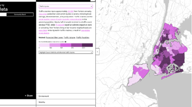
In New York City, streets and sidewalks make up the majority of public spaces — and it matters how this space is used. The width of a street, the presence of a bench, or the size of a park affects the health, accessibility, and resilience of any given community. Where a wide street means more traffic fatalities and more pollution, a narrow road can mean safer street crossings, cleaner air, and easier access to outdoor recreation — and as a result, improved outcomes in health, education, economic opportunity, and quality of life. The way that public space is used is the result of policy decisions that too often lead to inequities in public health, infrastructure access, and the environment.
In New York City, there is a direct correlation between who lives in a neighborhood and how public space is used. Simply put, public space in wealthier, whiter communities is less likely to be used for car and truck traffic, and more likely to be used for benches, street trees, bike lanes, and bus lanes. As a result, these communities see less asthma, fewer heat deaths, and fewer traffic fatalities and benefit from shorter commutes, more mobility choices, cleaner air, and a wealth of other positive outcomes. These relationships are reciprocal: Public space in low-income communities and communities of color is less well funded and more likely to serve people outside the community (such as a highway, as compared to a local bus or bike lane). As a result, the environment, health, and mobility of these communities suffer.