
Map, Measure, Plan & Monitor: Creating Equity through Integrated Landscape Management & Urban Metabolism
Mapping, measuring, planning and monitoring complex systems in the real world is the foundation for effective action. The course focused on a joint approach to the use of technology development and community innovation in mapping complex physical, social and environmental contexts, measuring key attributes, formulating innovative interventions and monitoring dynamic interactions, between natural systems and human health and livelihoods. The coupling of two diverse contexts (Colombia and Morocco) highlights the common elements that constitute the emerging field of Urban Science and DUSP pedagogy, a combination of computation, participation, and reflection grounded in real social and environmental problems in an age of environmental degradation and climate change.
All students studied Mocoa during the first half of the semester. Some of them continued deepening the work in Colombia during the second half. Based on interest and availability, a sub-group of students traveled to Ben Guerir in order to develop a second case study. All students participated in shared seminar sessions at MIT where the different fieldwork experiences informed and enriched the theoretical discussions.
In Colombia, work centered on the study of the City of Mocoa, in the State of Putumayo. This work built on a DUSP workshop held in IAP 2018, where Professor Phillip Thompson, PhD Student Juan Camilo Osorio and the MIT Community Innovators Lab (CoLab), worked with nine MCP students to document existing conditions that explored preliminary recommendations that helped shape current and future work by MIT in the region. Through that work, the group created mutual interest and the institutional foundation to launch a long-lasting partnership between MIT and various public and non-governmental actors in Colombia -- including academic partners, such as the Putumayo Institute of Technology, which is the main university in Mocoa. In close collaboration with all of its partners, during the last year and a half MIT has developed a toolkit of innovative approaches to reduce environmental risk and socioeconomic vulnerability in Colombia, while enhancing pathways to sustainable use of forests in dialogue with public & private entities and local communities.
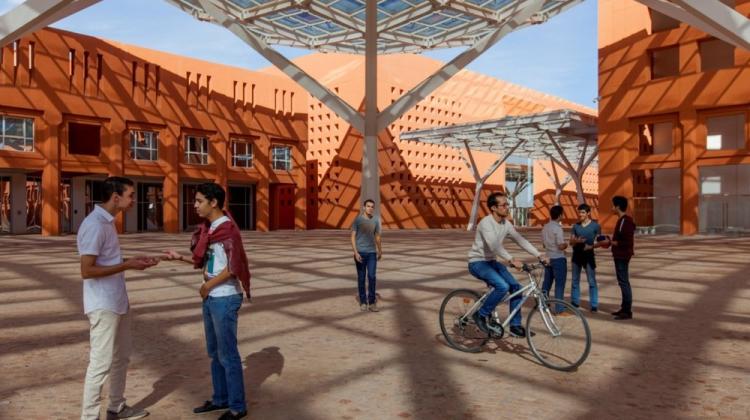
The second group of students focused on the City of Ben Guerir, Morocco. The course built on a long-lasting partnership between the Department of Architecture’s Urban Metabolism Group (UMG), the MIT Environmental Solutions Initiative (ESI) and the Government of Morocco. The UMG has been working in Morocco for approximately 6 years, with an intense partnership with the Université Mohammed VI Polytechnic (UM6P) during the last 2 years. To date, the UMG has directed the development of a comprehensive material flow analysis of the city of Ben Guerir with our partners at UM6P and begun the planning for developing an online resource calculator for all Moroccan cities. The ultimate goal will be to generalize this work to the MENA region.
Both groups explored the advantages of integrated landscape management (ILM) and urban metabolism (UM) in the process to stabilize socio-environmental challenges and opportunities. This includes environmental restoration, sustainable use of the forest and ecosystem-based adaptation (EbA) to climate change. In Mocoa, the challenges include enlisting the community in sustainable development, while taking steps toward mitigating carbon emissions and adapting to various climate change impacts. This is an urban settlement with a population over 36,000 people that is expected to continue growing rapidly at the fringes of the Amazon frontier -- a region heavily affected by deforestation, severe weather changes and violence deriving from Colombia’s endemic armed conflict. In April 2017, Mocoa was struck by a massive landslide of mud, rocks and flood waters that destroyed buildings and infrastructure, killing over 250 people and injuring over 200 more. There are systemic factors creating this level of vulnerability that are not unique to Mocoa, with over 300 municipalities in the country that are currently threatened by similar threats.
In Ben Guerir (Morocco), the challenges include rapid urbanization in a critically resource-constrained environment while enlisting local communities in sustainable development. In addition, the very real threat of extreme heat driven by climate change will pose an acute challenge to urban populations. This group focused on real-time data acquisition using drones and other devices and spatial analysis for understanding the current and evolving urban metabolism of Moroccan cities.