
Site and Environmental Systems Planning
The Site Planning class is the oldest, continuously taught course in the School of Architecture + Planning at MIT. Since its first offering in 1935 it was taught by only a handful of instructors including Kevin Lynch, Donald Appleyard, Tunney Lee and Gary Hack. In 1956 Kevin Lynch took what was seen as a mainstream course in site engineering and turned it into a whole–system approach to planning the built and natural environments.
Since 2000, under the direction of Eran Ben-Joseph, and later on Mary Anne Ocampo the class has incorporated hands-on, client-based projects dealing with an array of prevailing environmental and site systems planning issues. These include: hurricane devastated areas in Biloxi, MS the retrofitting of housing developments in Tama, Japan and the transformation of contaminated waterfront sites in Bronx, NY.
Related Publications
East Boston - 2021
The students of the Department of Urban Studies and Planning (DUSP) at the Massachusetts Institute of Technology (MIT) 2021 Site and Environmental Systems Practicum (11.304j) created four interactive pamphlets for the East Boston community as tools to support their participation in planning processes.
Through the lenses of environmental justice and climate resiliency, the class studied sites throughout East Boston, investigating neighborhood development and the complex regulations of East Boston’s extensive waterfront. The set of four pamphlets the class produced are tools for sharing information and ideas, they may be read together as a set or as individual pamphlets. They illustrate East Boston’s power and decision-making processes, offer storytelling as a creative way to understand East Boston’s past and future, and propose new visions for Condor Street in Eagle Hill and Harbor View in the Belle Isle Marsh.
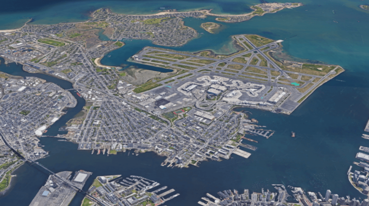
INDUSTRIAL REMIX Integrating Manufacturing in Regio Parco, Torino
InfraUrbanism: Designing a Resiliency Framework for Pellestrina Island
This Site and Environmental Planning workshop investigated resiliency strategies for Pellestrina, Italy, a barrier island that separates the Venetian Lagoon from the Adriatic Sea and protects the world heritage city of Venice and lagoon islands from storm events. Since the flood of 1966, the most devastating historic event that flooded Venice with more than three meters of water, the Italian State has been focusing on planning initiatives to protect urban areas from high waters, safeguard the coastal islands from storm events, restore lagoon ecosystems, and plan for socio-economic development on the islands within the 550 km2 area that makes up the lagoon area. Pellestrina, an island of fishing and agricultural villages spread along the 11 km coastline, has always acted as part of the larger infrastructure protecting Venice and the Lagoon, but how is Pellestrina being protected?
https://issuu.com/mit-dusp/docs/2019_mit_dusp_venice_report_sm
A Handbook for Complete Communities in Austin
As Austin embarks on a potential new land development code to accommodate its rapid growth, an exploration of the city's planning processes and appropriate mix of housing typologies questions the role of current community-based approaches to urban design.
https://issuu.com/mit-dusp/docs/handbook_for_complete_communities_-_single_pages_-
Emancipation Park Neighborhood: Strategies for Community-Led Regeneration in the Third Ward
Beginning in the summer of 2015, students from the Department of Urban Studies and Planning at MIT began working with residents of the Emancipation Park neighborhood, a historically African-American community in Houston, Texas. The first group of students helped the Emancipation Economic Development Council establish a set of working groups to study key community issues. A second group of students prepared a report building on previous work and a practicum in the Spring of 2016.
https://issuu.com/mit-dusp/docs/mit_dusp_houston_workshop_report_ju
Muntinlupa Matters: Addressing Informality in Metro Manila Executive Summary
In January 2015, a group of MIT students and professors traveled to Manila for a two-week site visit that included extensive fieldwork, stakeholder interviews, community meetings, and design charrettes. Students from MIT and UP worked collaboratively to understand the history and present context of development, settlement, and natural disasters in relation to informailty and vulnerability and then brainstromed approaches to addressing these complex challenges.
https://issuu.com/mit-dusp/docs/2017-06-11_executive_summary_single
Planning Boston's Bicycle System and Completing the City’s Streets
The MIT Site and Urban System class (11.304/4.255) worked with the City of Boston Director of Bicycle Programs and Toole Design Group to develop a comprehensive and integrated bicycle plan and street design that enhance a livable public realm, are shared by all modes of travel equitably, and are responsive to environmental conditions.
Tama New Town, Japan
The Spring 2009 Site Planning studio is a continuation of a long-term research project initiated in the summer of 2008 and followed by the Advanced Japan Design Workshop of Fall 2008. The research project rethinks the future of housing development within the context of developing a prototype for sustainable urban community. It utilizes Tama New Town outside Tokyo as a reference for the work. The Studio was funded and conducted in part in collaboration with the staff and resources of Sekisui House Ltd. of Japan.
The goal of the Site Planning Studio was to create a manual for Ecologic Oriented Development and infrastructure design that derives from the study area’s typologies. Rather than providing a single plan, the purpose of the manual is to create a flexible set of codes/typologies that account for site variability. In addition to outlining techniques and intervention points, the manual also includes few permutations of how these techniques could be synthesized and employed at the neighborhood scale.
Weston Nurseries Site Hopkinton
Weston Nurseries comprises +/- 700 acres of land (more than 5% of the total land area of Hopkinton). For the last several years the owners of the property have been investigating ways to extract value from the land to enable the business to re-invent itself for the next generation of the family. Most recently, there has appeared in the marketplace an offering of 615 acres of nursery property for sale.
This offering presents Hopkinton with an enormous opportunities and challenges. What and how much should be developed? Which areas should be preserved? What is the right development? What are the pros and cons of the possible uses and the future costs associated with it?
Due to the size, location and landmark significance of the Weston Nurseries property, the Town wishes to identify and explore all commercially reasonable means to acquire the Site, including but not limited to an outright purchase by the Town or formal or informal partnerships with developers, land conservation groups, and other interested organizations.
During the course the class worked with the Town of Hopkinton Land Use Study Committee to analyze, evaluate and develop site planning scenarios for the site in accordance with local objectives.